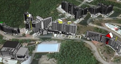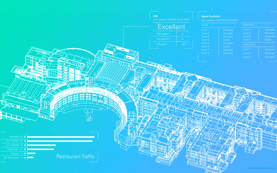
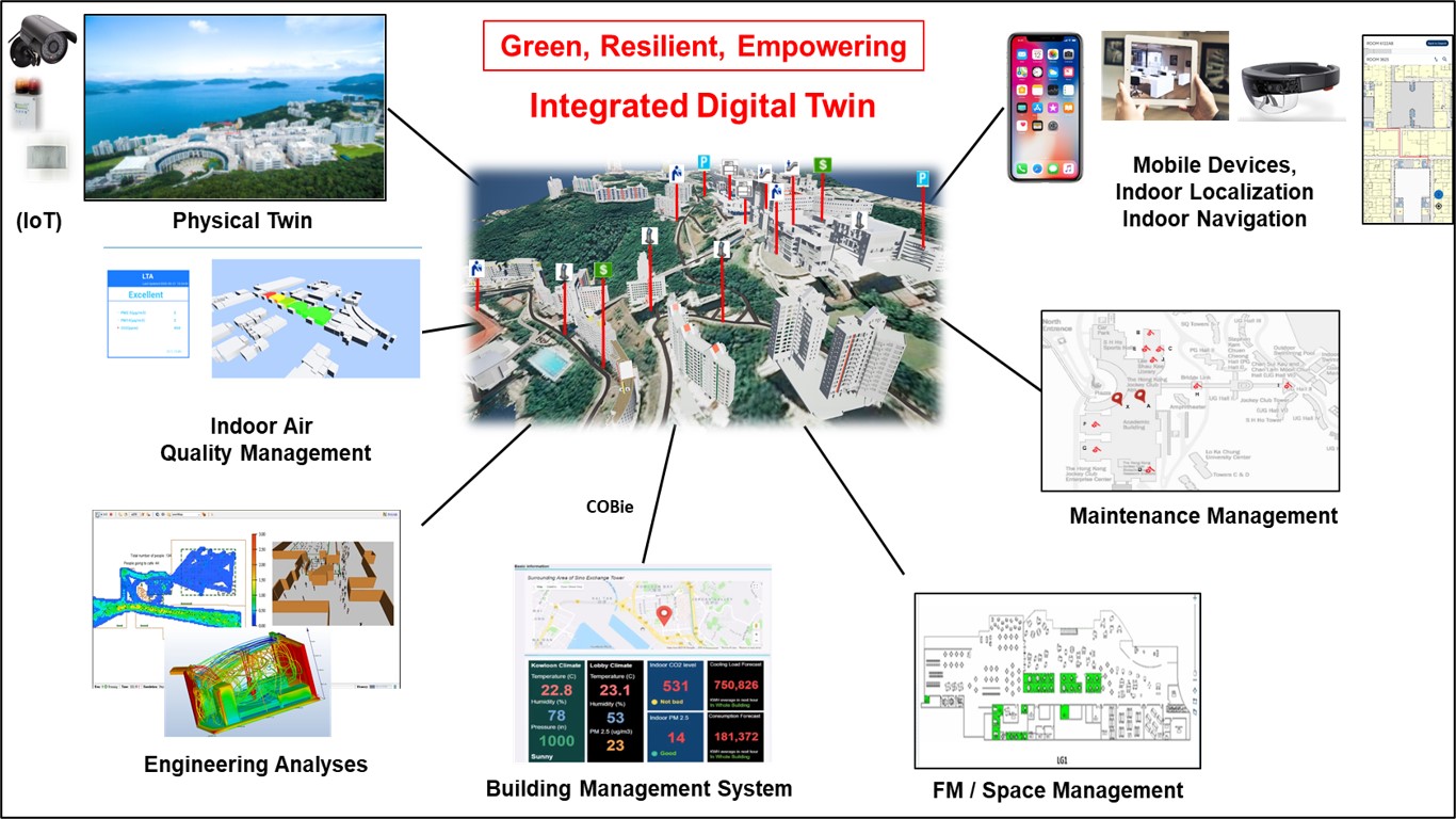
The Hong Kong University of Science and Technology (HKUST) campus carries a vision of creating a digital twin, which digitizes the physical world with different facility systems integrated into a single hub. The project will significantly enhance facility management (FM) like engineering analyses, operation management and maintenance. Diverse data sources are available, including building information modeling (BIM), geographic information system (GIS), Internet of Things (IoT) and building management system (BMS).
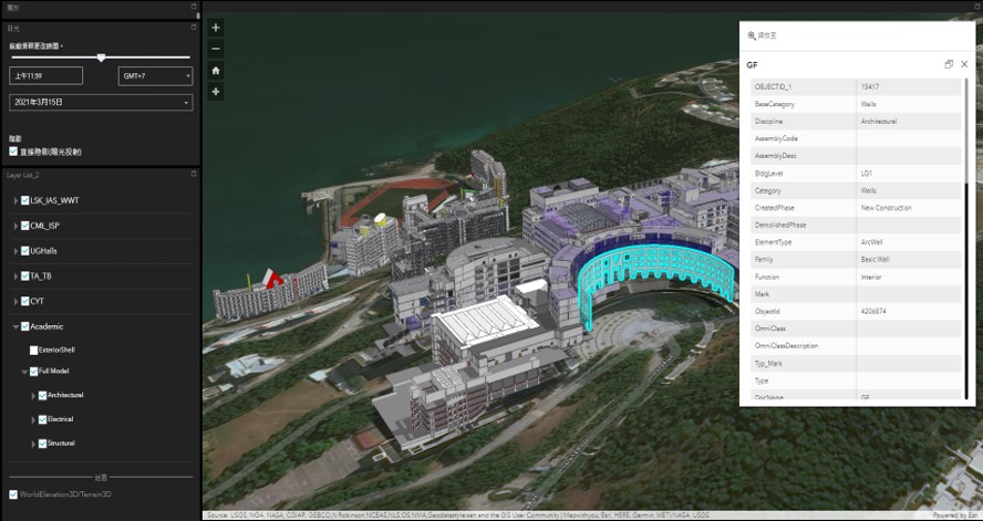
Considering openBIM, a IFC data model is proposed for seamless BIM-GIS integration, capturing a realistic 3D topology of the entire HKUST in rich details. IFC schema is seamlessly interoperable with GIS platform, where an online dashboard is developed for web-based model interaction and query
The BIM-GIS model is then integrated with distributed IoT data based on openGIS, where an extended CityGML model is proposed to incorporate real-time IoT data, which are parsed from other HKUST portals with Python API. A mobile app is developed for general public to interactively query the operational performance, like indoor air qualities.
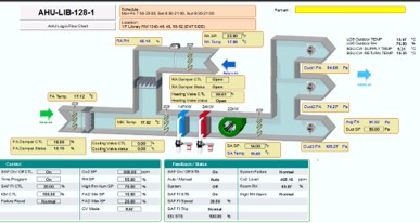
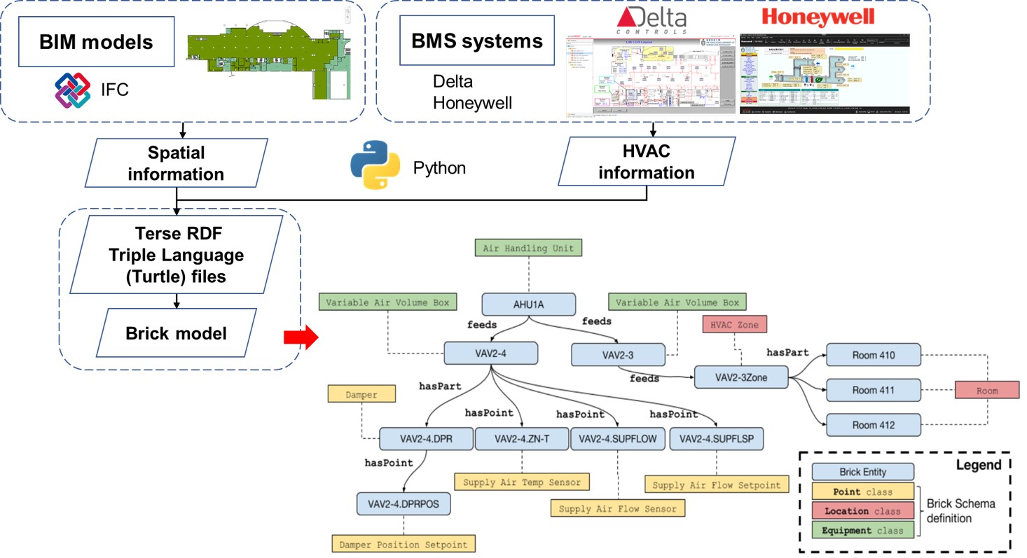
The BMS data are also integrated into the BIM-GIS model, including air-conditioning system performance. With an open ontology called Brick schema, the functional interaction between BMS and surrounding geometry is effectively captured.
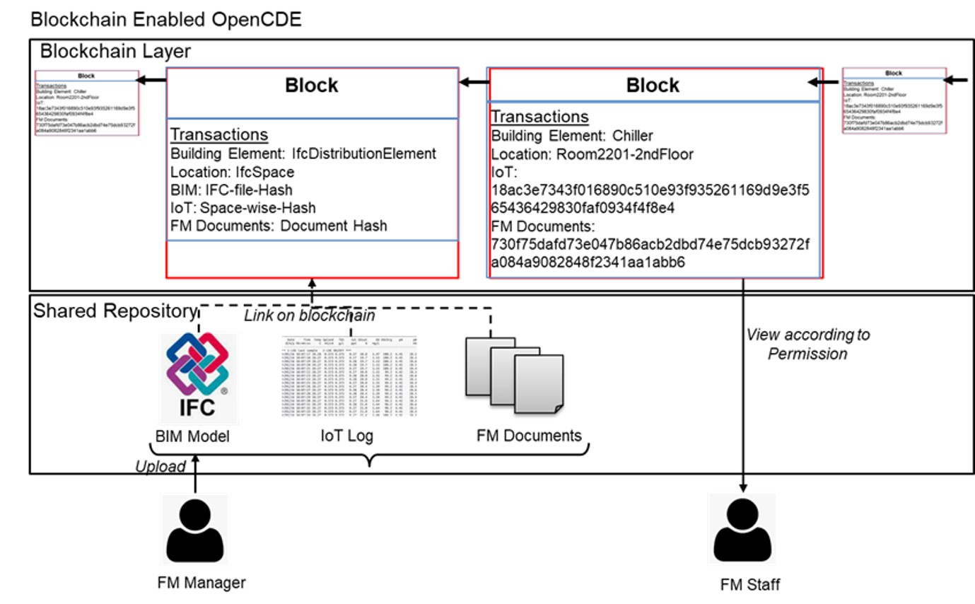
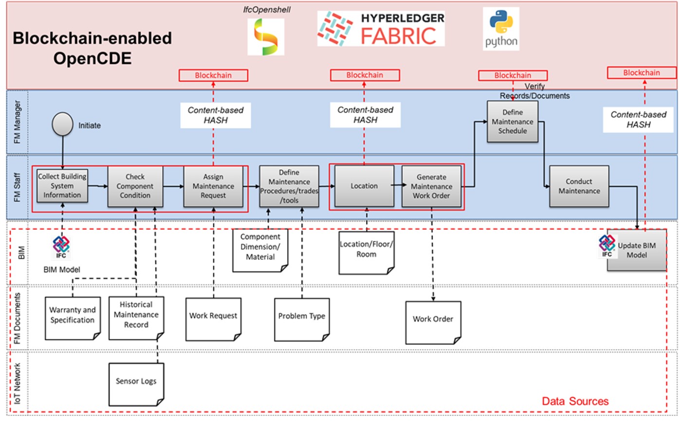
A secure openCDE is developed with a blockchain model, which encrypts FM data and authenticates a staff's permission level before granting access privileges. Data sharing are guaranteed high integrity, authentication and transparency among different FM parties.
A workflow is developed to realize BIM-GIS data integration based on openBIM, such that a large-scale digital twin is generated to support both microscopic analyses and macroscopic management. Hence, a IFC data model is proposed to govern the attribute modeling in BIM, as well as the data transfer to GIS. Based on the proposed IFC schema, individual buildings/spaces of an area are constructed. In addition, a methodology is proposed to reduce the file size, by combining architecture components while keeping room masses separate, minimizing the graphical rendering loads for smoother visualization.
3D BIM models were created for the whole campus in Revit. The BIM reconstruction totally covered more than 60 buildings, 20,000 rooms and floor area 500,000 square meters. Individual BIM sub-models are imported to a GIS platform, which effectively supports IFC data interoperability with a BIM-GIS data mapping scheme, and geo-referenced to the appropriate location, such that the overall topology is reconstructed. The BIM-GIS model integrates various data sources (including buildings, landscapes and topology) into a single hub, which is published online to allow information query or management by different parties. The figure below shows the web dashboard developed for interacting with the BIM-GIS model (e.g. component attribute query).
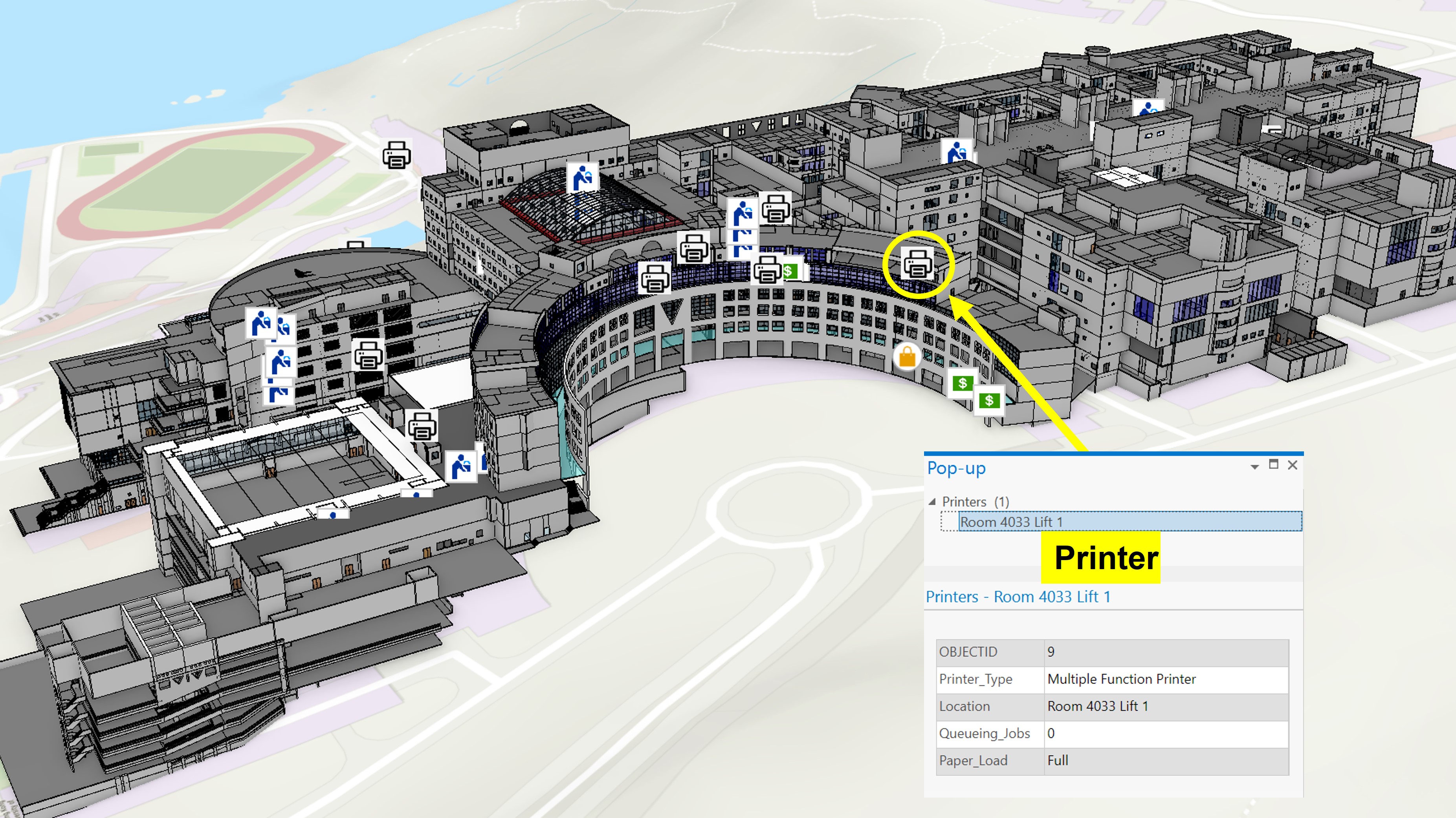
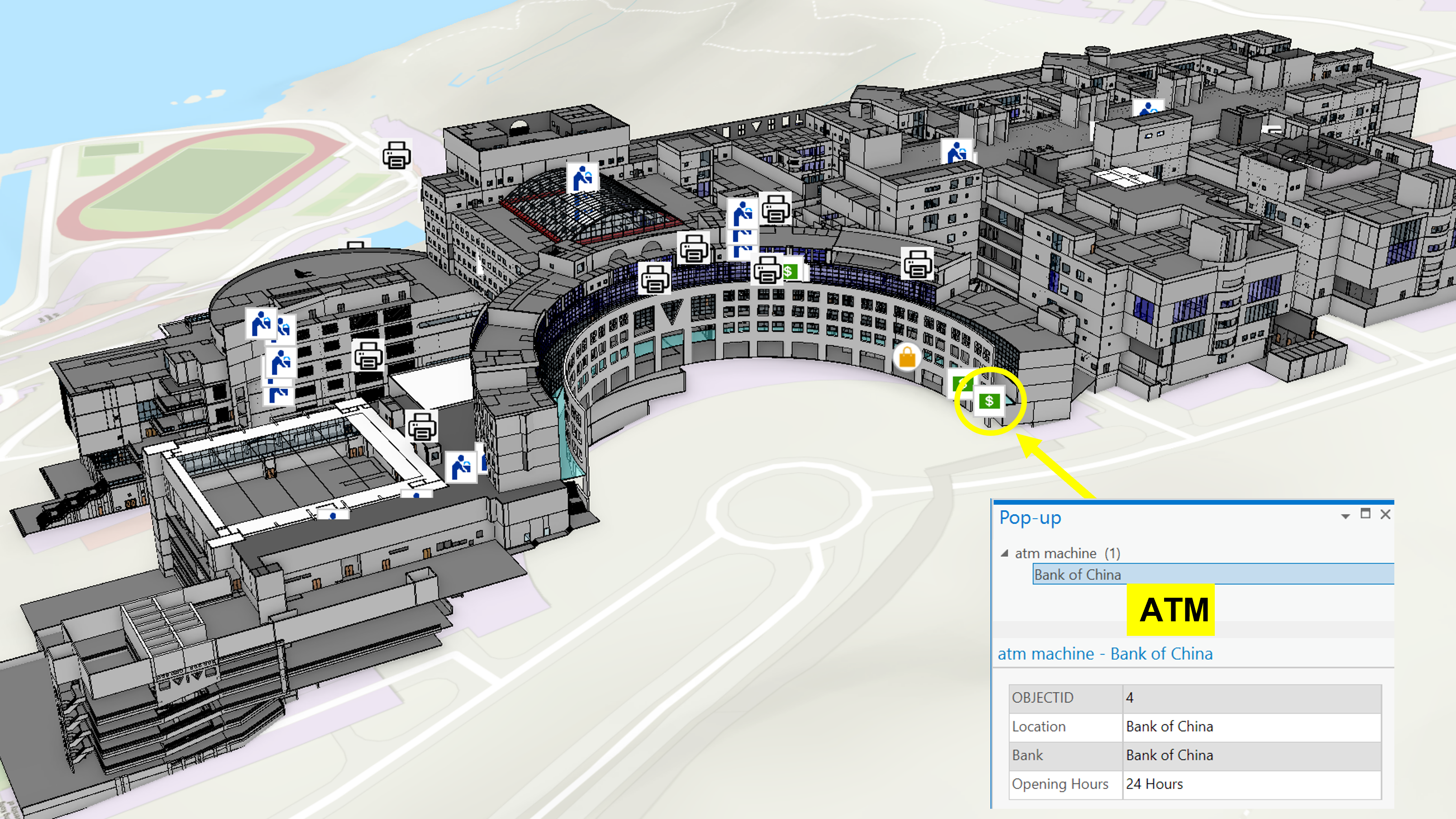
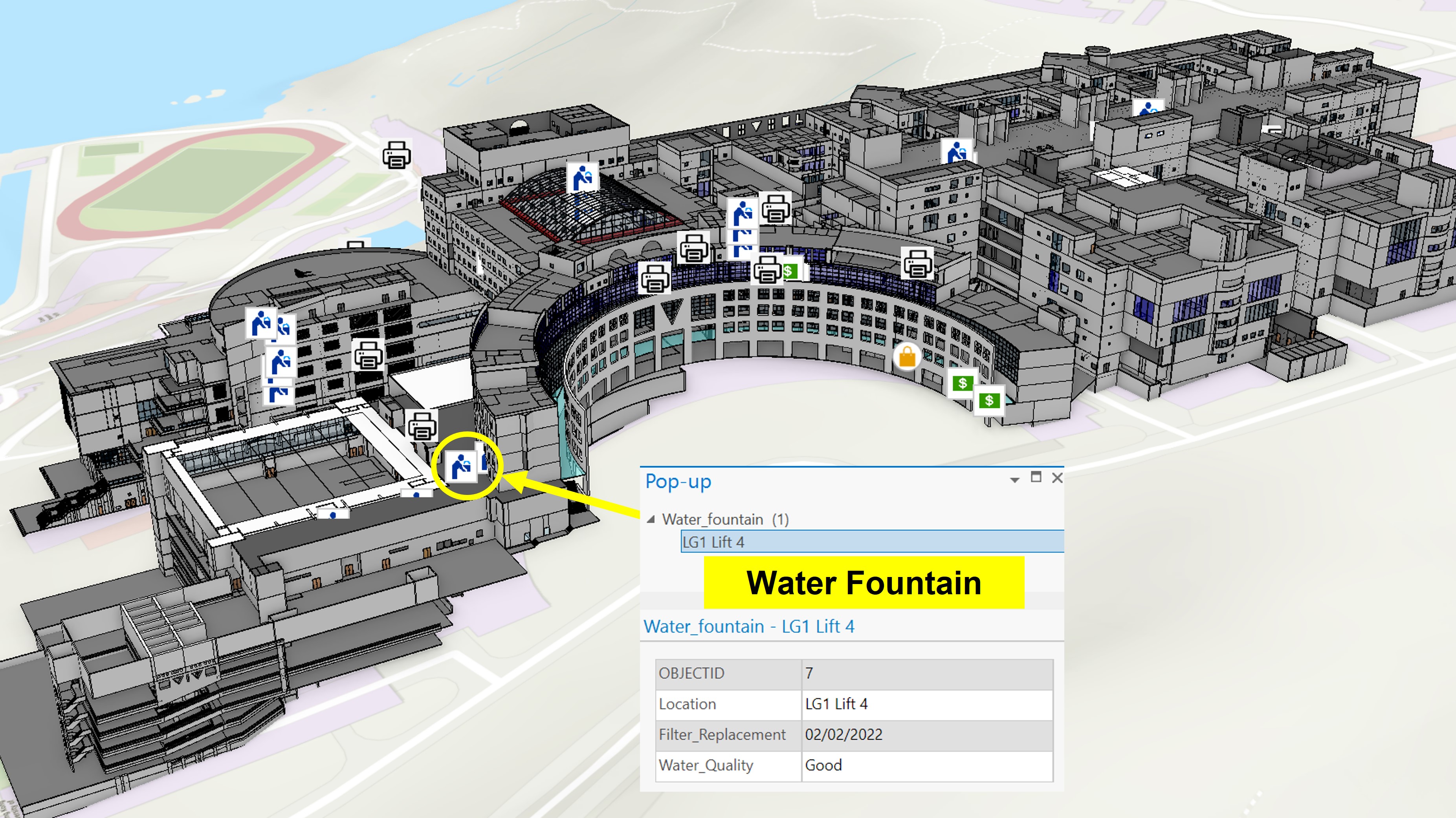
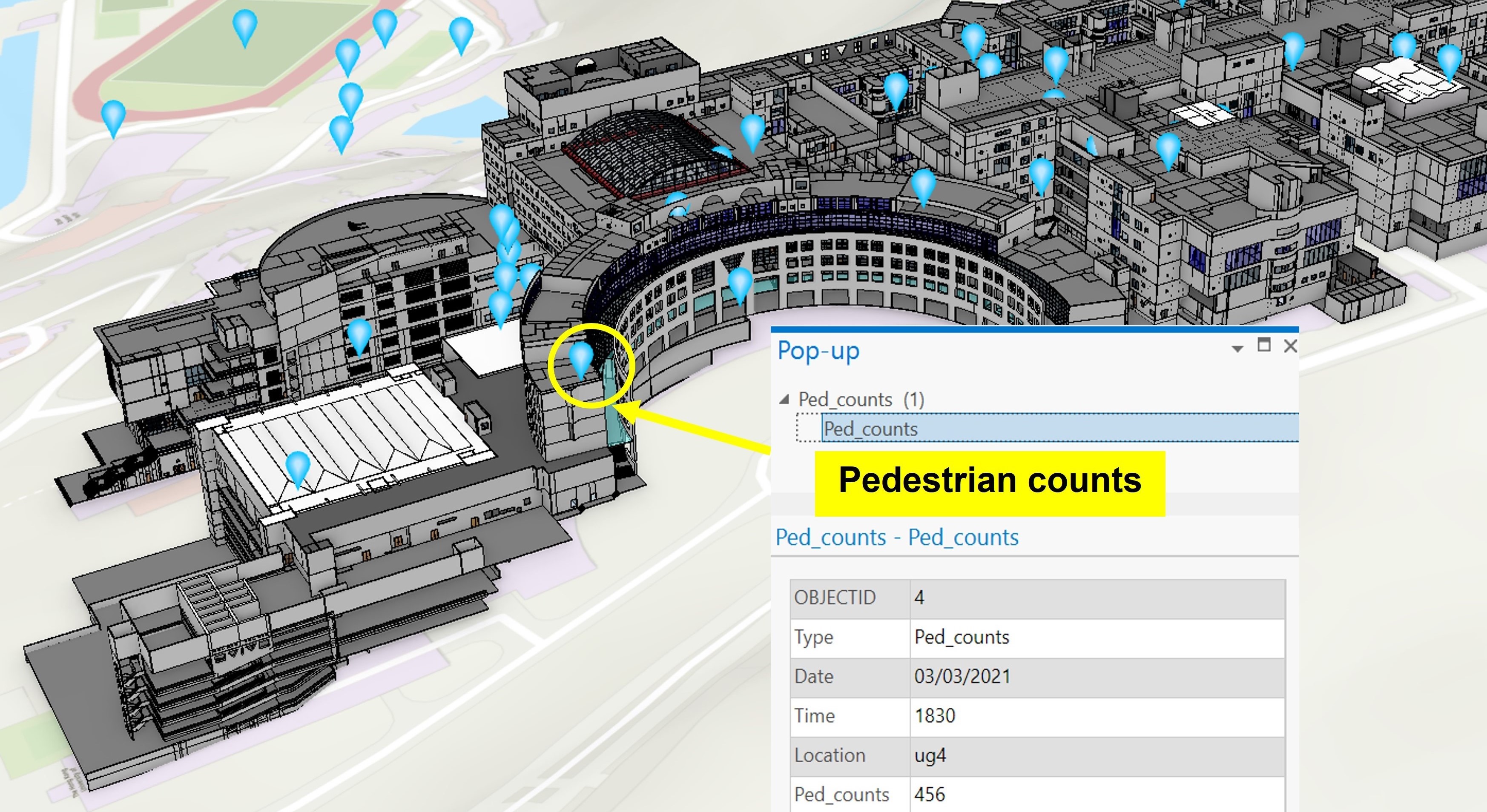
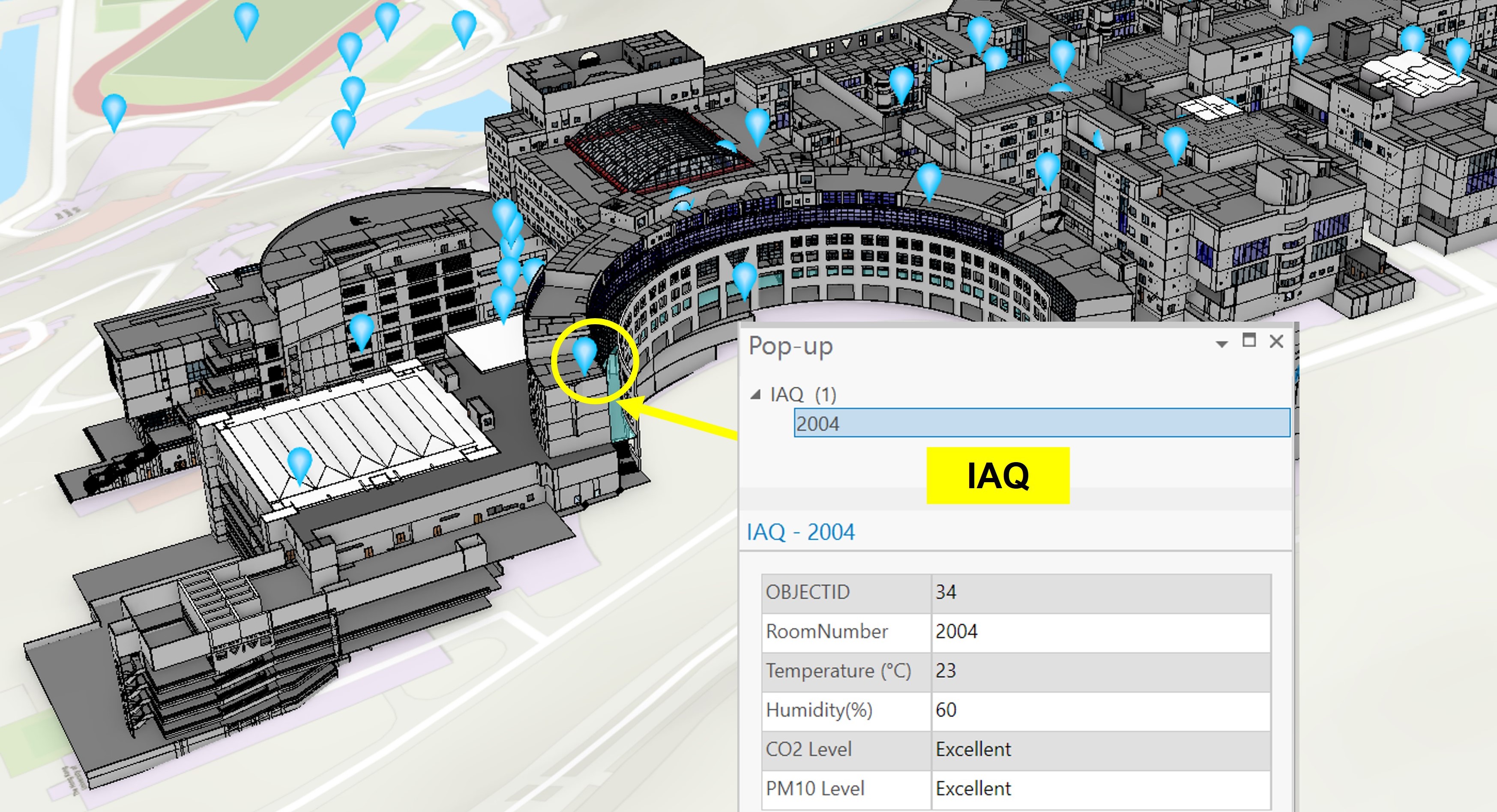
Facility condition monitoring is supported by integrating IoT data with BIM-GIS. BIM/GIS stores a digital model of the facility, and locations of individual IoT device are identified in the digital model and then associated it with the device-specific measurements from the correct device. A data model based on CityGML is developed to formalize the necessary IoT-related attributes. Different points-of- interest (POIs) data sources and IoT data from other HKUST databases were effectively extracted and integrated into the BIM-GIS model. These include the real-time pedestrian counts from the HKUST Pulse system based on WIFI localization, the IAQ measurements from the SCAN platform such as temperature and humidity at different locations.
An interactive mobile app is also developed for querying real-time IAQ at a user-specified room as demonstrated in the video below. For smoother user experience in mobile devices, the BIM models were down-sized and exported to a game engine.
Panoramic images are integrated with the digital twin platform for different purposes. A virtual tour platform is developed, and 360-degree panorama scenes with floorplans are integrated to provide a realistic and holistic view of facilities and the environment to better understand the target facilities and environment. Various hotspots are labeled in panorama scenes to show various feature types, while an inserted map or floorplan, generated from BIM software, is placed to show the scene's location. In this way, the overall visualization display is also enhanced with the combination of digital twin models and panoramic images.
To integrate the BIM-GIS model with the BMS data (e.g. HVAC information), a data model based on the Brick ontology schema is proposed to formalize the semantic descriptions of building assets and their relationships. The figure above summarizes the overall workflow of generating a Brick ontology model by integrating the openBIM and BMS data. The Brick model summarizes the hierarchical relationships between the HVAC components (e.g. AHUs, VAVs, zones and points). Hence, the operational statuses like supply air temperature can be monitored, which can enable energy performance evaluation or predictive maintenance of HVAC components.
BIM-GIS-BMS data integration based on open ontology HVAC information from BMS platforms were extracted, while spatial information were extracted from BIM models based on IFC files to ensure data interoperability under openBIM standard. Python programming was implemented to automatically process the data sources and generate a Brick model. By integrating the BIM-GIS and BMS data, facility managers can effectively query necessary information for routine/ proactive/ predictive maintenance of the HVAC components, as well as IAQ assessment for optimizing occupant comfort or energy efficiency.
An openCDE framework based on blockchain is developed and integrated with the BIM-GIS platform for secure data management among different parties. The blockchain data model provides a unified and data-neutral record to track who did what and when throughout the lifecycle of a facility. The framework consists of two layers, (1) a blockchain layer for integrating graphical and non-graphical information from different data sources in a secure manner and (2) a shared repository for the storage and graphical and non-graphical information. The blockchain layer provides the security of irreversibility and prevents the information from being over-written and provides a method for viewing/auditing information as required by FM processes, securely and effectively.